
Tour du Mont-Blanc (TMB)
June to September
Challenging - 3,5 / 5
Tour du Mont-Blanc (TMB)
June to October
*** Group or customized itineraries ***
The summit of the French Alps
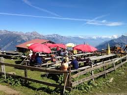
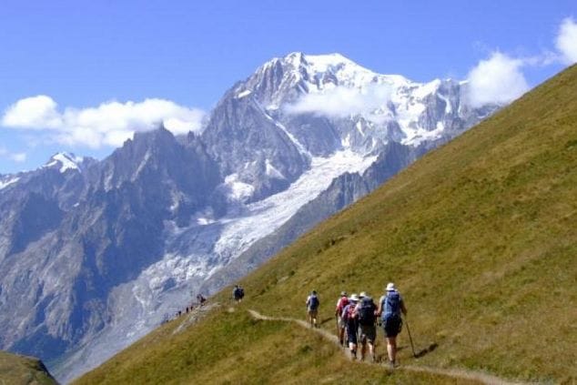
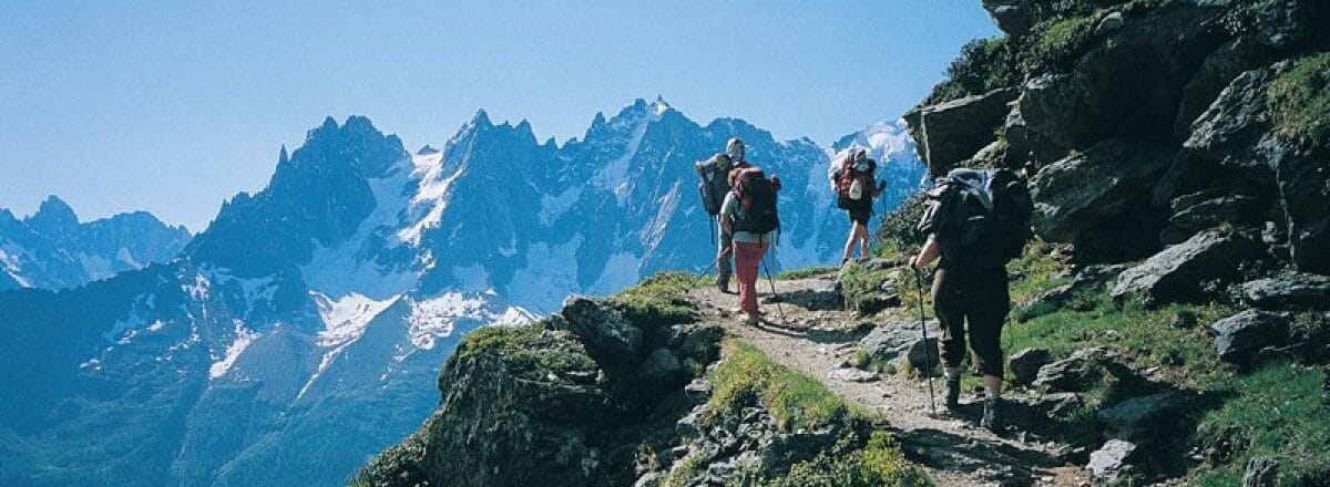
The Tour du Mont-Blanc, also known as “TMB”, is a mid-mountain hike that crosses 3 countries, offering 3 different sides of the Mont-Blanc Massif: the Italian side with its towering rock faces, the Swiss side with its gentle valleys, and the French side with its immense glaciers…
We work with an agency based in the Chamonix region, which enables us to offer you “tailor-made” tours, according to your budget, fitness level and availability. Tours are available with or without a guide. A GPS map will be provided for your telephone.
Guided or self-guided itineraries, from 5 to 10 days, to discover all the facets of the highest massif in the Alps.
See 2 examples in the Itinerary tab.
VIDEO of our 2018 group: Enjoy this 4-minute video of Hugo Fortin on the TMB (Tour du Mont Blanc) circuit from September 2018.
NB: Itinerary and walking times are given as a guide only.
These tours are available on your own or with a professional guide.
Highlights:
- Visit 3 countries: France, Switzerland and Italy,
- Maximum altitude 2537m, average 1525m,
- Certified guide (if desired),
- Luggage transport,
- Private transfers as indicated in the program.

Discover the Tour du Mont Blanc in comfort with this itinerary offering the best panoramas of the famous tour. Discover three countries and three Alpine cultures in just 6 or 7 days!
This tour is designed for active people with mountain hiking experience. At the junction of three (3) countries, the majestic Mont-Blanc can be enjoyed on foot through France, Italy and Switzerland, each with its own unique landscapes and culture.
Day 1: LES HOUCHES – LES CONTAMINES: +750m, -1300m, 12km
Bus transfer to Les Houches. Departure by Bellevue gondola. The hike begins at the foot of the Aiguille du Goûter, the starting point for the ascent of Mont Blanc. Depending on the group’s fitness and the conditions, you can either climb to the Col de Tricot and Truc via a beautiful route at the foot of the glaciers, or descend directly to Les Contamines via a beautiful path between clearings and forest. Overnight in the village of Les Contamines.
Day 2 LES CONTAMINES – ROSELEND: +1350m, -800m, 18km
We take the “voie Romaine” path, the start of the climb to the Cols du Bonhomme and des Fours, our morning’s objectives. Then a beautiful descent to the alpine pastures amidst the Tarine cows, the Beaufortin welcomes us. Short private transfer to our hotel, ideally situated on the shore of Lac de Roselend.
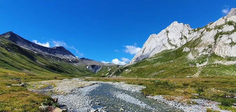
Day 3 ROSELEND – COURMAYEUR: +750m, -850m, 20km
Short private transfer to the start of the hike. The Col de la Seigne welcomes us after a fine climb. The scenery is magnificent, with Mont Blanc on the Italian side. The Val Veny unfolds as we reach Lac Combal. Short transfer to Courmayeur, where we explore the town center.
Day 4 Free day at COURMAYEUR or short hike
Short hikes in the surrounding area or cable car ride to Mont Blanc. For the hike, we plan to take the bus from Courmayeur to Lavachey, climb to the Bonatti hut and then return to Courmayeur via the Bertone hut. The hike is +450m, -700m and takes around 4h30.
Day 5 COURMAYEUR – LA FOULY: +950m, -900m, 14 km
Short transfer to the start of the hike at Arpnouva and direct ascent to the Col Grand Ferret, where Switzerland welcomes us. This morning, we walk opposite Mont Dolent, straddling three countries. A pleasant descent to the Peule mountain pasture, where you can learn all about traditional mountain farming and raclette cheese-making. Or descent via the Petit Col Ferret into a wild valley.
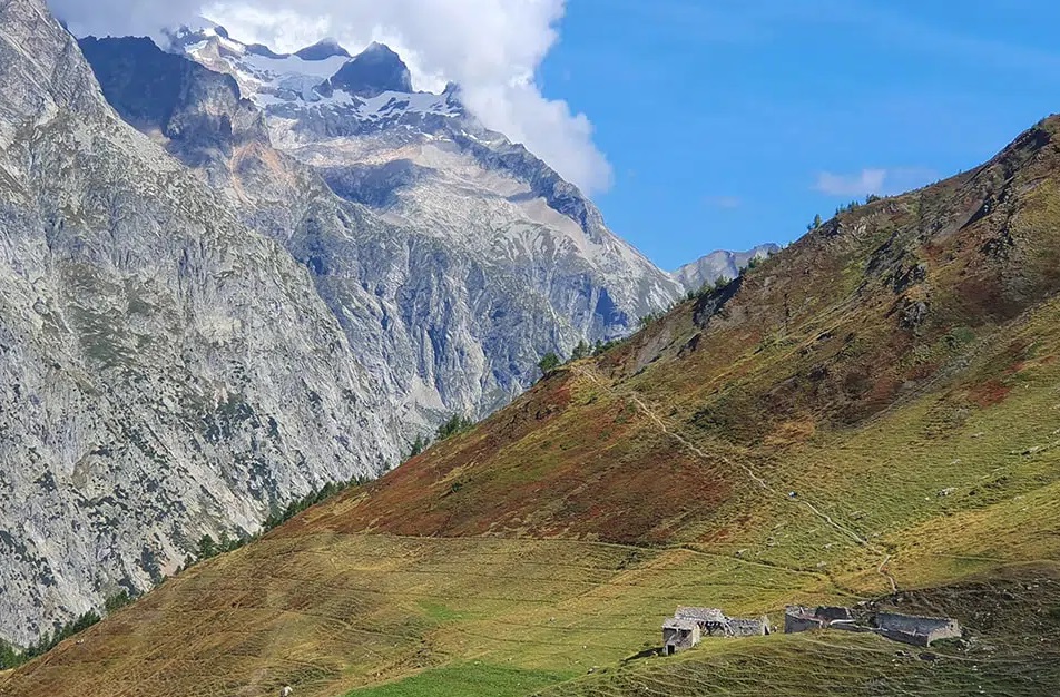
Day 6 LA FOULY – CHAMPEX – TRIENT+800m, D-900m, 18 km
Private transfer to Champex, then start of the hike. Passage through the famous Arpette window, depending on snow conditions and group fitness. Alternatively, detour via Bovine overlooking the Rhône valley.
Day 7 TRIENT – ARGENTIERE – CHAMONIX: +1000m, -800m, 9 km
It’s time to return to France via the Col de Balme, from where the view over the Chamonix valley is breathtaking. The little village of Le Tour awaits you at the bottom, before you reach Argentière. We reach Chamonix by train or bus.
End of the tour around 4pm in Chamonix.
With our partner, we offer you the classic version of the Tour de Mont-Blanc, the TMB. Please note that this version is for experienced hikers, and is rated 4 out of 5 in terms of difficulty. Please consult us before making any decisions.
Day 1: Grand Balcon Sud to Argentière :
From Chamonix, walk to Les Praz to take the cable car to La Flégère (1900m). Today’s trail is called the Grand Balcon Sud and is located on the opposite side of the Mont Blanc valley, offering a beautiful view of the massif to the south.
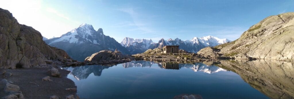
At the start, the trail skirts the landscape, then climbs to reach the highest point of the day, Lac Blanc (2352m).
The trail then passes the beautiful Lac de Cheserys and descends to Argentière (1240m).
In the afternoon, there’s a very short section of steep ladders/steps to descend.
Distance 12.5 km / Ascent: +450m; -1010m / 8.5h walking time, including breaks and dinner.
Hotel Standard (breakfast)
Day 2 – Col du Balme – Col de la Forclaz
You start with a short walk to Montroc, at the top of the Chamonix Valley, to take the path up to the Aiguillette de Posettes (2201m).
The trail climbs, descends a little and then climbs again to the Col de Balme (2191m), before crossing the French-Swiss border.
This section offers excellent views of the Aiguille d’Argentière and the Aiguille du Tour and its glacier.
You then head for the small Swiss village of Trient (1296m), with a view of the glacier of the same name.
The day ends with a steep climb back to the hotel on the Col de la Forclaz (1527m).
Distance 17 km / Difference in altitude: +1200m; -1130m / 8.5h walking time.
Basic hotel (breakfast, dinner)
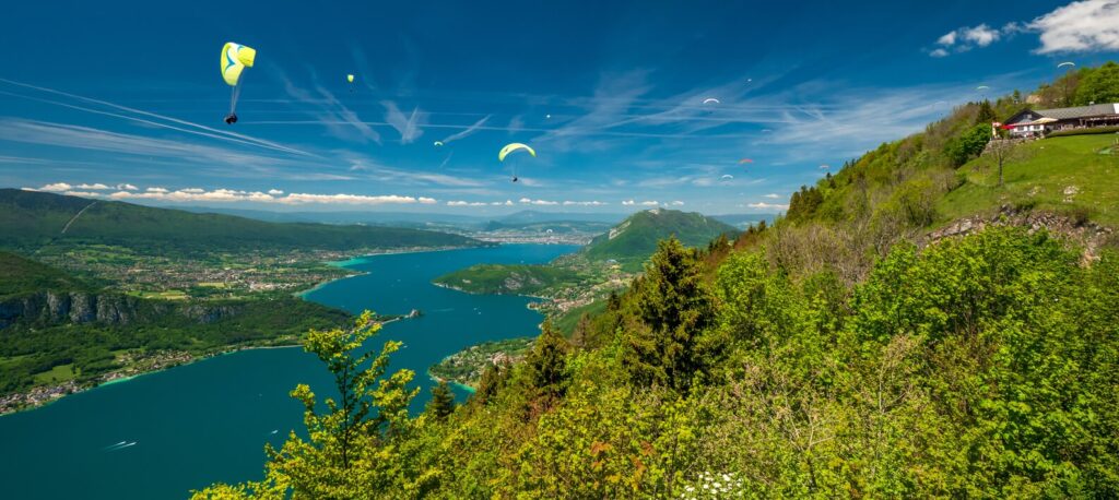
Day 3 – Col de la Forclaz – Alpage de Bovine – Champex
You leave the Col de la Forclaz, with a direct view of the Rhône valley and the Swiss town of Martigny. You continue your hike along a historic path once used to drive cows to the Bovine mountain pasture (2049m). The trail then winds through meadows and alpine pastures before beginning its descent to the charming town of Champex (1486m), set beside a picturesque alpine lake.
Distance 13 km / Ascent: +650m; -710m / 7h walking time.
Standard hotel (breakfast, dinner).
Day 4 – Champex – La Fouly
From the east side of the main Mont Blanc massif, the trail now heads south, descending through the forest to Val Ferret and Issert (1055m) and other small alpine villages. It’s a good day for admiring the flowers, including orchids. You continue up the valley to the isolated village of La Fouly (1600m). It lies at the foot of Mont Dolent, whose summit is the meeting point of France, Switzerland and Italy.
Distance 15 km / Difference in altitude: +545m; -415m / 6h walking time.
Basic hotel (breakfast, supper)
Day 5 – La Fouly – Grand Col Ferret – refuge Walter Bonatti
Following the same valley and the La Drance river, the trail climbs to Grand Col Ferret (2537m), the highest pass of the hike. Now in Italy, the valley retains the name Val Ferret. The view of the surrounding mountains is breathtaking, dominated by the Grandes Jorasses. The trail then descends to Arp Nouva (1770m), then climbs back up and makes a short traverse to the Walter Bonatti refuge (2025m). Rooms are available with 2 or 4 beds. It’s a wonderful place to spend the night and experience a mountain refuge (there’s no luggage delivery to the hut). It is always possible to exchange for a night in a hotel in Courmayeur. Please inform us at the time of booking. In this case, luggage will be delivered to the hotel. Subject to availability, the price should be the same, but dinner will not be included.
Distance 17 km / Ascent: +940m; -780m / 8h walking.
Mountain hut (breakfast, dinner).
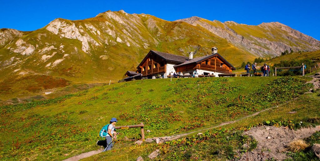
Day 6 – Refuge Walter Bonatti – Mont de la Saxe – Courmayeur
If you’ve spent the night in Courmayeur, after a short trip by local bus, you join the trail and climb to the refuge Walter Bonatti. From the refuge (2025m), the hike continues via a beautiful bypass around Mont de la Saxe to Courmayeur. You’ll be able to see the southern slopes of the Mont Blanc Massif, the steep slope of the Grandes Jorasses, and the glaciers on the northern side of the Val Ferret. In the afternoon, it’s a long, steep descent to Courmayeur (1230m), a town with excellent ice cream!
Distance 13 km / Ascent: +375m; -840m / 7h walk.
Standard hotel (breakfast)
Day 7 – Courmayeur – Col de la Seigne – Les Chapieux
After a short bus ride to La Vissaille (1660m) in the Val Veny, the TMB trail climbs gently beneath the imposing Miage glacier, past Lac Combal, before climbing more steeply along the old Roman road to the Col de la Seigne (2516m), the point of return to France. A steep descent takes you to the Ville des Glaciers (1789m). Finally, after a fairly long day’s walk, you arrive at Les Chapieux (1553m), a small, remote village inhabited only during the summer months.
Distance 20 km / Ascent: +860m; -970m / 8h walk.
Basic hotel (breakfast, dinner).
Day 8 – Les Chapieux – Col du Bonhomme – Les Contamines
Having now reached the south-western point of the circuit, the route takes you northwards to climb once more. First, there’s a fairly long, steep climb up to the Col De la Croix du Bonhomme (2478m), which you then bypass. From here, the trail descends rapidly over meadows, crossing a Roman bridge to reach Les Contamines (1180m).
Distance 17 km / Ascent: +925m; -1300m / 8h walking time.
Standard hotel (breakfast, dinner).
Day 9 – Les Contamines -Col du Voza – Les Houches
A challenging day, with several ascents and descents. From Les Contamines, the trail joins the TMB road up to Chalets de Miage (1560m). From here, the trail climbs steeply to the Col de Tricot (2119m) before descending and passing close to the Glacier de Bionnassay. There are fine views of the northern side of the Mont-Blanc massif. The trail then climbs up to reach the Col de Voza (1652m), from where you can see the Chamonix valley and begin the descent to the village of Les Houches (993m).
Distance 16 km / Difference in altitude: +1100m; -1100m / 8.5h walking time.
Standard hotel (breakfast, dinner)
Day 10 – Les Houches – Brévent – Chamonix
Crossing the northern side of the Chamonix Valley, the trail climbs steeply through a pine forest to emerge on the mountainsides and then reach the highest point of the day at Brevent (2525m). It’s a long day’s walk that offers the best views of the French side of Mont Blanc and its neighboring peaks. The trail then descends to Plan Praz (1970m), where you have the option of taking the gondola back to Chamonix (1061m) for a well-deserved drink!
Distance 12 km / Ascent: +1550m; -526m / 7.5h walking time.
Standard hotel (breakfast).

Price
We offer several tours to suit your preference and physical condition.
Talk to our specialist Jean Ricard at 819-771-6271 or jean@inspirationsvoyage.com.
Tour du Mont-Blanc (TMB)
Would you like to make a reservation? Do you have any questions? Don't hesitate to contact us!
Stay informed about our upcoming adventures
Subscribe to our newsletter to receive information on our adventure trips and activities, as well as tips on how to make the best travel choices.

